I grew up in County Wicklow, which is called the Garden of Ireland. My parents used to take us for long drives at the weekend through the countryside. We would stop at parks and forests. I loved the rolling hills and the mountain peaks. I decided at a young age that I was going to hike in some of the most beautiful places in the World. Thankfully, I have managed to complete a few hikes on my list.
In this post, I provide a short outline on each hike, based on my experience. I have also identified where you can hike alone or where you have to travel in a group.
Everest Base Camp, Nepal
Route – Everest Base Camp & Gokyo Lakes Trek
Duration – 20 days
Highest Point I went – Kalla Pataar 5,545m (18,192ft)
Can you hike alone – No
My Tour Size – 14
Sleeping Quarters – Tea Houses
My estimate of the difficulty – Hard, really, really hard. It was an extremely long trip.


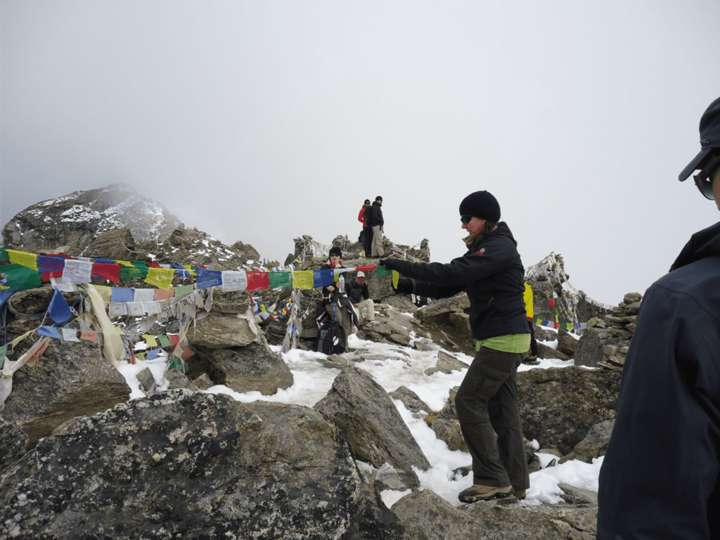
I wrote a post all about this so please read that. This was by far, the most challenging of the hikes I have done but it was incredibly rewarding.


Kilimanjaro, Tanzania
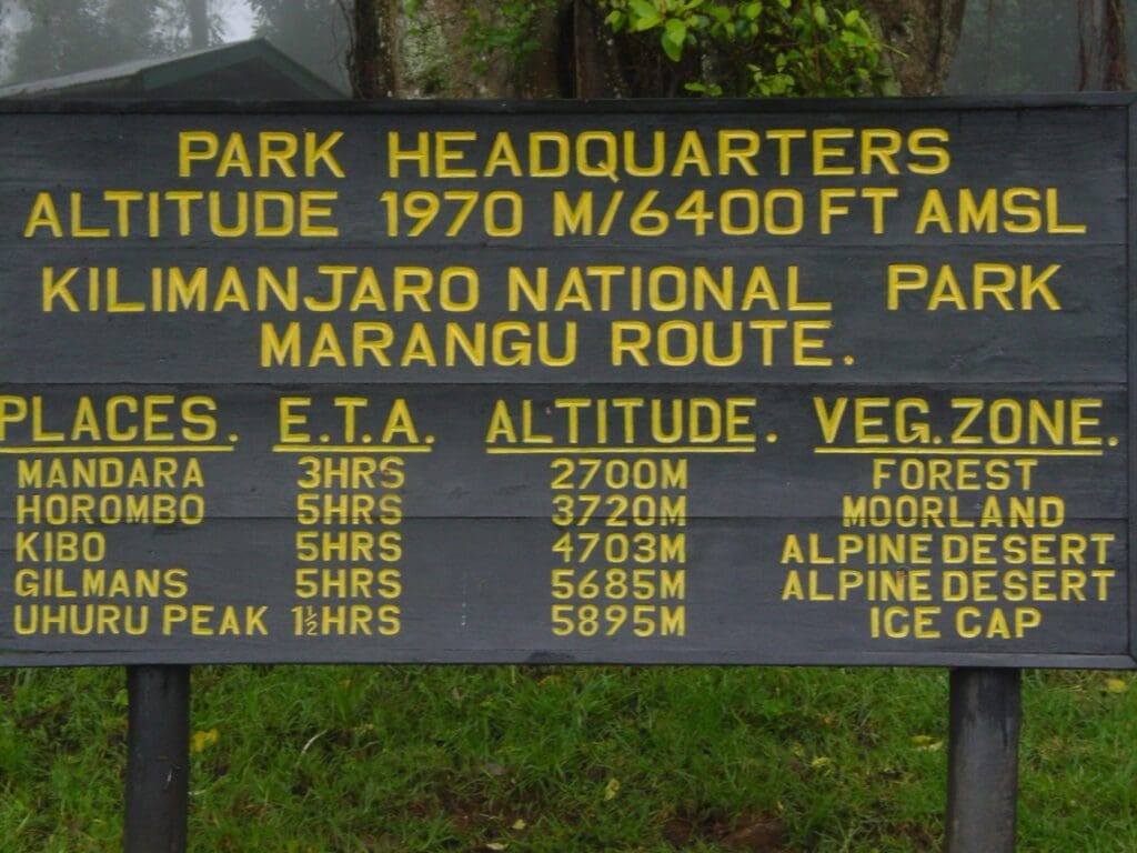
Route – Manangu Route
Duration – 6 days
Highest Point I went – Uhuru Peak (Top of Kilimanjaro) 5,895m (19,341ft)
Can you hike alone – No
My Tour Size – 1 plus guide and porter and cook (I went at a very quite time of the year)
Sleeping Quarters – Basic Huts
My estimate of the difficulty – Hard, really, really hard


I wrote a post about this so please read that. I found the night / morning we summited extremely difficult.


Inca Trail, Peru
Route – The Inca Trail
Duration – 5 Days
Highest Point I went – Cusco as Machu Picchu is lower
Can you hike alone – No
My tour Size – 7
Sleeping Quarters – Camped in tents
My estimate of the difficulty – It certainly has it’s challenging moments, particularly the last morning
I went on an organised tour, which included a few other places also. The tour started in Lima and included flights and bus journeys. We travelled to Ollantantaytambo, Cusco and to lake Titicaca.
We left at 4.15am the morning we started the Inca Trail as there were reports of protestors blocking roads. We did meet some of them and the road had been blocked in two places (stones placed across, which we had to move to pass through). It did feel quite disrespectful moving them but they didn’t resist us doing so and we replaced them before moving along. The guide told us the protesters wanted to stop delivery trucks from crossing but didn’t worry about small tour groups like ours.
We walked for 8-10 hours every day. The terrain differed quite a bit. Sometimes it was very steep and you walked on stonework. One day, we seemed to walk down steps for hours. It rained a lot for two days, making conditions cold and slippy.
We had one guide, who was excellent. He was extremely knowledgable about plants, herbs, flowers etc and would regale us with details about them. It seemed as if the Incas had a use for everything. Every sentence started with “This is the ancient Inca remedy for ….”. It was fascinating.
Our tents were assembled at our camp site each evening before we arrived. We would eat together in a large one and play cards and chat with the guide and porters during the evenings. As I was travelling alone, I was in a small tent single person tent at nighttime.
It rained very heavy on the last night. We were camped very near to a river and I remember waking up a few times, thinking the tent was moving and wondering if I would end up in the river.
Due to the bad weather, we were unable to walk on the trail on day four and had to walk along a train track. Only two trains passed through thankfully. We were all glad when we arrived at Aguas Calientes, the nearest town to Machu Picchu.
We left the camp at 4.30am on the last morning to walk the final steps to Machu Picchu. It was extremely difficult as I was exhausted and it was cold. I did wonder if I would be able to complete the last section and it really was a challenge.
We were one of the first groups to arrive at Machu Picchu and we saw the sunrise at the Sun Gate. The sky cleared and the sun lit up the whole area. It was one of the most spectacular sights I have seen. There really are two types of tourists in Machu Picchu. There were people like us that had clearly hiked the trail, were disheveled, exhausted and needed a shower. Then there were lots of tourists (mainly Japanese) getting off coaches looking very refreshed carrying massive cameras.
The site itself dates back to 1450. It is considered one of the Seven New Wonders of the World and was declared a Unesco World Heritage Site in 1983. It is 2,430m (7,970 feet) above sea level. Cusco is 3,400m (11,200 ft) making it great place to acclimatise in, before starting the Inca Trail. Machu Picchu is often called the Lost City of the Incas and the literal translation is Old Mountain. Unfortunately I lost all my photographs when I had my laptop stolen (sometime later) and I hadn’t a back-up. Please excuse the quality of this image (I took it and it is hanging on the wall in my living room but this copy doesn’t do it justice)

I throughly enjoyed the Inca Trail. The history of the area is amazing, the scenery breathtaking and it was an extremely challenging few days.
Carrauntoohil, Ireland
Route – Up – “The Devils Ladder”, Back via “The Heavenly Gates”
Duration – 5-6 hours
Highest Point I went – 1,038.6m (3,407ft) Top
Can you hike alone – Yes
My tour Size – 1 + guide (lots of options are available, I went at a quiet time so was alone)
Sleeping Quarters – N/A
My estimate of the difficulty – Medium, good level of fitness required to complete in this length of time


Carrauntoohil is the highest mountain in Ireland. It is part of the MacGillycuddy reeks in County Kerry in the south west of Ireland. Killarney is the nearest town which is about a 55 minute drive to the start. The direct translation of Carrauntoohil is Tuathal’s sickle. Tuathal is an old Irish mans name and sickle is a tool used when harvesting crops.
The mountain is made of sandstone. The terrain is a mixture of mountain paths and rock steps. The views of the valleys and lakes along the way are really beautiful. You will also see a mixture of lots of shades of green, which Ireland is famous for.
There is a wooden cross at the top of Carrauntoohil. There are also signs explaining the dangers of the terrain around the top. You really can only descent from one area and it would be treacherous to try and leave from other places. You can see above how cloudy it is in my summit photo.
You don’t need any specialist equipment to climb this. I do suggest you bring hiking poles. However, the weather can change drastically. You should be very careful about weather reports and only head out once it is safe to do so.
You can hike it alone. I went with a guide as was alone and also had some time constraints. I had travelled down to Killarney for two nights with some family and I just had one day to complete this. There are lots of tour groups in Killarney and the surrounding areas which arrange tours to the summit. As I was the only one on my tour and I am quite an experienced hiker, the guide took me back down via a more difficult route.
I really enjoyed this hike, although it rained a lot, the cloud was often thick, impacting visibility. However, it was a goal of mine to summit the highest peak in my home country.


Yosemite, USA
Route – You can select your own and enter the park from numerous entrances
Duration – I spent 6 days in Yosemite
Highest Point I went – probably 2,700m (8,858ft)
Can you hike alone – Yes
My tour Size – N/A as hiked alone
Sleeping Quarters – Comfortable cabin at a resort
My estimate of the difficulty – It depends on trails you take and whether they go up hill. It can be very hot at certain times of the year also.


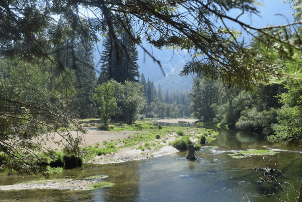
I wrote a post all about this so please read that (see below). Some hikes within the park are more challenging than others.


The Alps, France and Italy
Route – You can select your own
Highest Point I went – Various areas around 2,220m (7,200ft)
Can you hike alone – Yes
My Tour Size – 10 + guide
Sleeping Quarters – Refuges and hotels
My estimate of the difficulty level – It depends on the routes you take. The temperature can change drastically at times.


The Alps stretch almost 12,000 km (750 miles) across eight countries on mainland Europe. These are Monaco, France, Switzerland, Italy, Liechtenstein, Germany, Austria and Slovenia.
I spent time hiking in the French and Italian Alps a few years ago. You have lots of options to hike in this area and you can incorporate hiking with days in mountain towns and villages. I started in France and spent my first night in Argentiere, a small village in France at the foot of the alps. I then moved to Chamonix which is a very well known town for hiking enthusiasts. I met up with my tour group then. You can take daily tours from Chamonix by accessing starting points from local buses or cable cars. You can also stay overnight in the many refuges along the way. The quality of the accommodation varies but the foods is excellent at most of them.
After a week hiking in the French Alps we then crossed into Italy and stayed in Courmayeur a beautiful Alpine resort at the foot of Mont Blanc, 1,224m above sea level. This mountain town with its picturesque cobbled streets is another great place to base yourself. You can walk from the town into the Alps and immerse yourself in the beautiful landscape. The area is well signposted with signs showing distance, altitude and nearest mountain restaurant or rest stop. There is also a cable car, which can take you to the mountains and also links up with the Aerial Tramways in Chamonix. Couryameur, just like Chamonix in France is also a great destination for alpine skiers.
I thoroughly enjoyed my hikes in this area. Some days we walked for 8-10 hours and other days we walked for less time. The landscape does change at times but it is always beautiful.

Next on my list to complete !
Dolomites, Italy
Patagonia, Argentina
Atlas Mountains, Morocco
I would love to return to the Himalayas

6 thoughts on “My Six Favourite Hikes from around the World ”
Wow you’ve done some incredible hikes! This entire post could be a bucket list. I want to hike to base camp in Nepal one day but need to increase my fitness first for sure.
Thank you Steph,
I highly recommend the hike to Everest Base Camp. I loved Nepal. I did train quite a bit for it and I think building up your fitness level and stamina is important. However, altitude sickness can impact even the fittest people so is somewhat the luck of the draw. It’s worth it as it’s such a unique experience.
My problem is that I keep adding places to my bucket list so need to get a large hike completed again soon.
Thanks for reading this and for your comment.
Best Regards, Elizabeth
You’ve done some really incredible hikes!
Thank you Chloe,
Yes I have and I hope to do a few more while I still have the energy for them !
Thanks for reading this and for leaving a comment.
Best Regards, Elizabeth
Wow, you’ve done some epic hikes! I’m not much of a hiker but would love to do some easy hikes around the Alps. What a beautiful area of the world!
Thanks for reading this Riana and for giving me the opportunity to share it with your followers on X.
Yes I have done some great hikes. The Alps are a great options for easy day hikes. You can base yourself in one of the mountain towns or villages and get the bus or cable car to the start of the trails. The scenery is beautiful and it’s the perfect location for daily walks.
Thanks again, best regards, Elizabeth